Liniennetzplan Neuss
DE EN RU
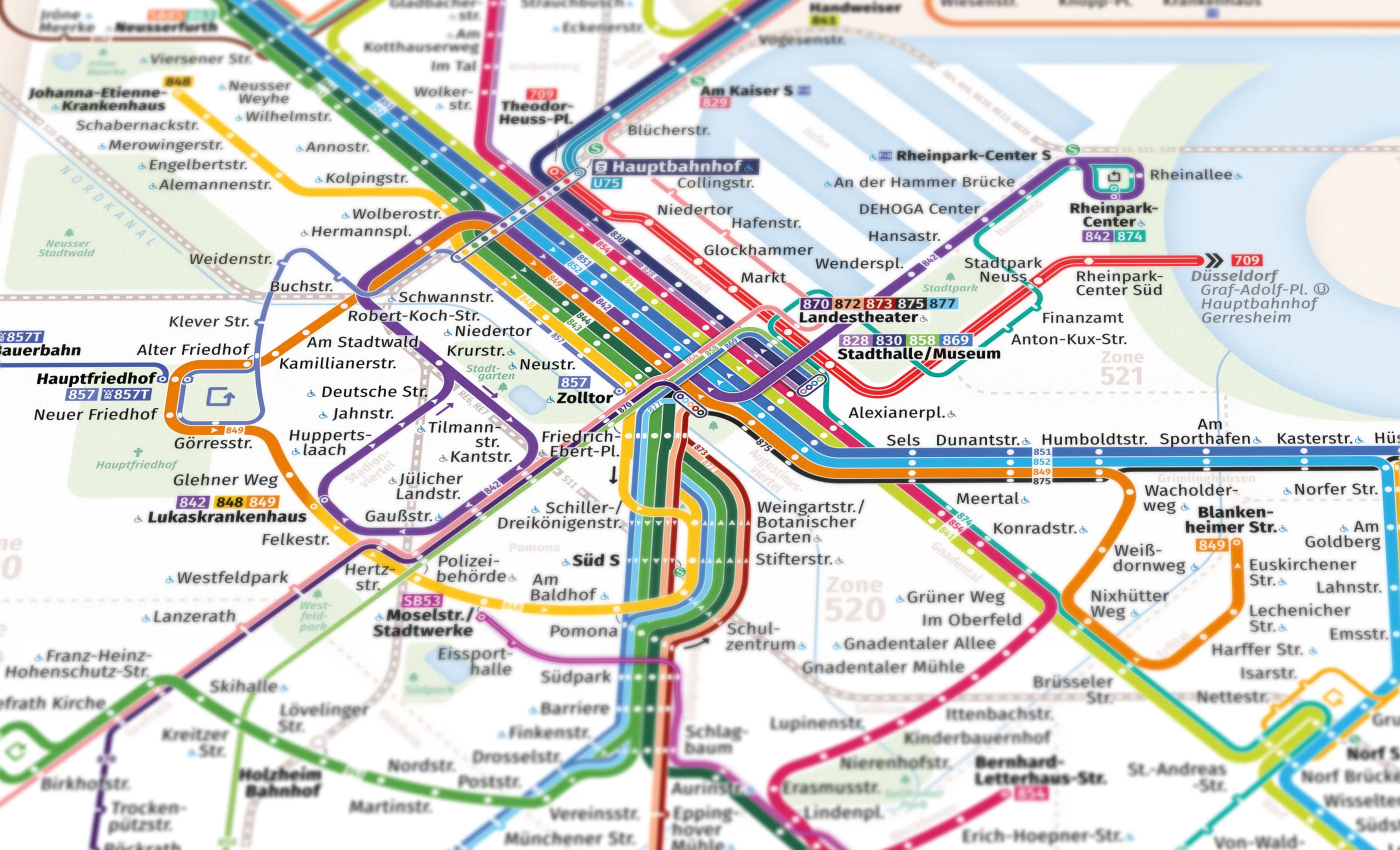
Liniennetzplan Neuss: transit map of every bus and rail line in Neuss on one sheet

Liniennetzplan Neuss

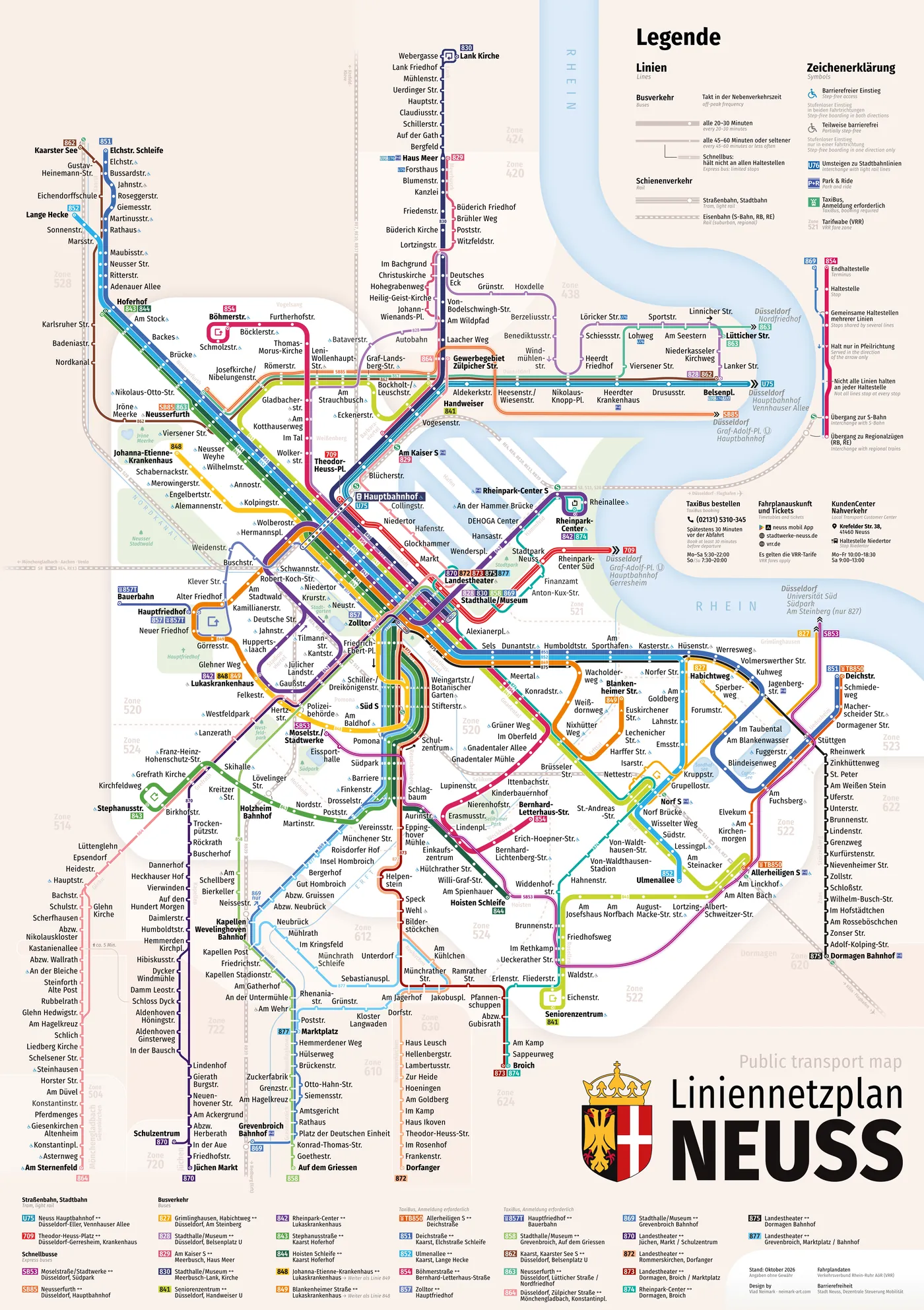
An unofficial transit map of Neuss: every bus and train on a single sheet.

Twenty-nine bus routes, tram 709, the U75, the S-Bahn and regional trains. All operators at once – Stadtwerke Neuss, Rheinbahn, BVR and NEW – because passengers don’t care whose bus gets them home.

I wanted the city I live in to have a map that is easy to travel by and a pleasure to look at. A map that lets someone seeing Neuss for the first time understand within seconds where a bus goes, where it turns, where to change and whether it’s worth waiting for at all.

So the map holds on to geography. The lines are straightened and laid on a 45-degree grid, but the Rhine flows where it flows, the harbour is recognisable by its outline, and the Konrad-Adenauer-Ring stays a ring. Looking at the sheet, you see a city, not a tangle of threads.

Hover over the map to get a magnifier. In full screen you can zoom in. Press and hold on the map to get a magnifier.

How to read the map

Seven decisions the map is built on. As you read, the map alongside shows each one.

  • Thick line: no need to check the timetable

    Thick lines run every 20–30 minutes; they are the backbone of the city. Thin ones run hourly or less often and reach the outskirts and neighbouring towns. For a thick line you can just turn up; for a thin one, better check your phone first. Where a route runs less often on the outskirts than in the centre, that’s where it gets thinner.

  • One colour, one route

    843 and 844, 851 and 852 share half their way and then split. So each pair is drawn in a light and a dark shade of one colour: on the shared stretch you can take either, and you only have to choose where they part. The other colours are chosen so that neighbouring lines in a bundle never blend, on paper or for colour-blind readers.

    So which routes are there?

    Tram and light rail

    • U75Neuss Hauptbahnhof ↔ Düsseldorf-Eller, Vennhauser Allee
    • 709Theodor-Heuss-Platz ↔ Düsseldorf-Gerresheim, Krankenhaus

    Express buses

    • SB53Moselstraße/Stadtwerke ↔ Düsseldorf, Südpark
    • SB85Neusserfurth ↔ Düsseldorf, Hauptbahnhof

    Buses

    • 827Grimlinghausen, Habichtweg ↔ Düsseldorf, Am Steinberg
    • 828Stadthalle/Museum ↔ Düsseldorf, Belsenplatz U
    • 829Am Kaiser S ↔ Meerbusch, Haus Meer
    • 830Stadthalle/Museum ↔ Meerbusch-Lank, Kirche
    • 841Seniorenzentrum ↔ Düsseldorf, Handweiser U
    • 842Rheinpark-Center ↔ Lukaskrankenhaus
    • 843Stephanusstraße ↔ Kaarst Hoferhof
    • 844Hoisten Schleife ↔ Kaarst Hoferhof
    • 848Johanna-Etienne-Krankenhaus ↔ Lukaskrankenhauscontinues as 849
    • 849Blankenheimer Straße ↔ Lukaskrankenhauscontinues as 848
    • TB850Allerheiligen S ↔ DeichstraßeTaxiBus, booking required
    • 851Deichstraße ↔ Kaarst, Elchstraße Schleife
    • 852Ulmenallee ↔ Kaarst, Lange Hecke
    • 854Böhmerstraße ↔ Bernhard-Letterhaus-Straße
    • 857Zolltor ↔ Hauptfriedhof
    • 857THauptfriedhof ↔ BauerbahnTaxiBus, booking required
    • 858Stadthalle/Museum ↔ Grevenbroich, Auf dem Griessen
    • 862Kaarst, Kaarster See S ↔ Düsseldorf, Belsenplatz U
    • 863Neusserfurth ↔ Düsseldorf, Lütticher Straße / Nordfriedhof
    • 864Düsseldorf, Zülpicher Straße ↔ Mönchengladbach, Konstantinplatz
    • 869Stadthalle/Museum ↔ Grevenbroich Bahnhof
    • 870Landestheater ↔ Jüchen, Markt / Schulzentrum
    • 872Landestheater ↔ Rommerskirchen, Dorfanger
    • 873Landestheater ↔ Dormagen, Broich / Marktplatz
    • 874Rheinpark-Center ↔ Dormagen, Broich
    • 875Landestheater ↔ Dormagen Bahnhof
    • 877Landestheater ↔ Grevenbroich, Marktplatz / Bahnhof
  • Rings

    The Konrad-Adenauer-Ring holds the whole map together, and other routes rhyme with it: in the south, the arcs of 843, 854 and 849 form a second ring. On the street they run a little differently, but you can see at once where to change from one radial route to another without going through the centre.

  • A stop never hides the line

    Stops on thick lines are white dots knocked out of the line: where two such dots sit side by side, you can change between the lines, and no separate interchange symbol is needed. Thin lines get short ticks with a notch, visible even when the line is pale. A terminus is a tick with a dot inside. No symbol covers the line: you can always see where it turns and where it ends.

  • Out on one street, back on another

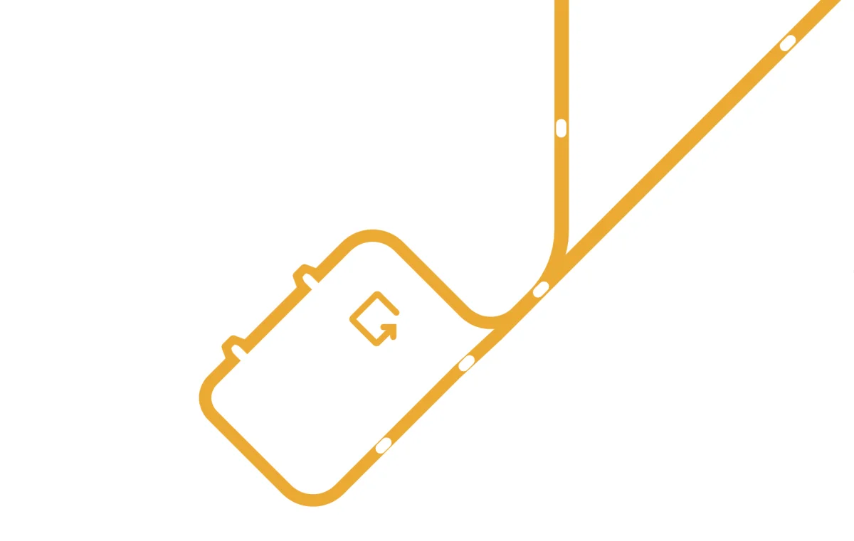
    Neuss has many one-way streets, and buses often take different roads in each direction. Where the paths part, the line splits into two thin ones, and arrows show the direction. If a bus only pops into a station and comes back the same way, as at Norf S, it is drawn as a little loop: you can change to the train here, but it isn’t the terminus, and the bus carries on.

    Detail of the map: a line loops into a station and comes back the same way
  • Express buses and rails

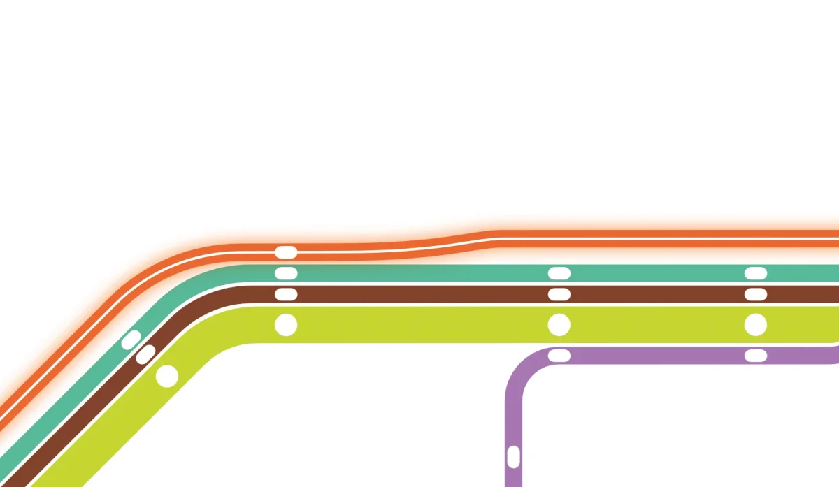
    The SchnellBus express routes SB53 and SB85 to Düsseldorf run alongside the bundle and only touch it where they stop, so you can see at once where to board. Tram 709 and the U75 are drawn with two white stripes, like rails: they go to Düsseldorf and must not get lost among the buses.

    Detail of the map: an express bus running alongside the bundle, a tram drawn with two white stripes
  • Beyond the city limits

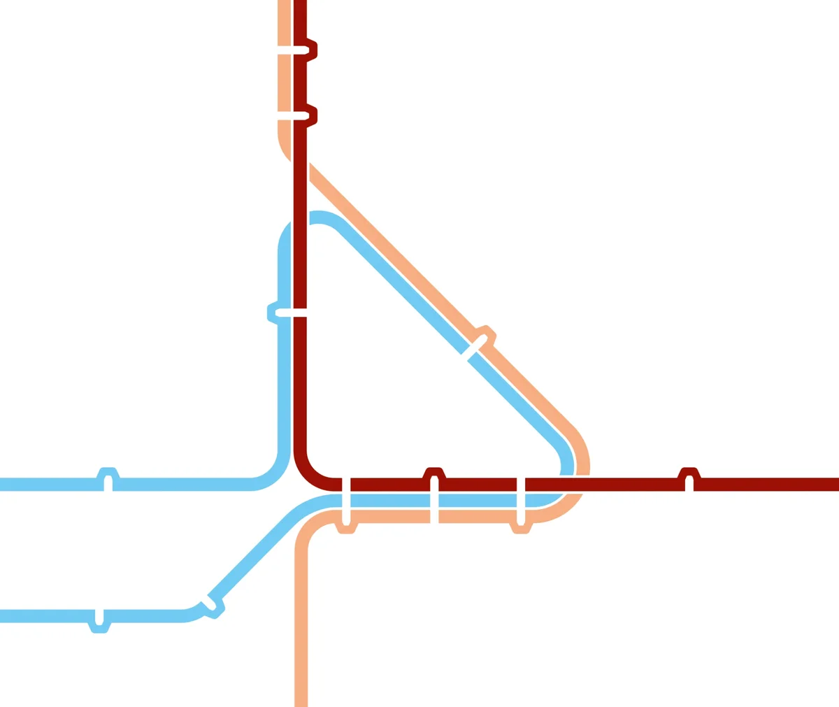
    Routes don’t stop at the edge of Neuss. You can see which of them go to Grevenbroich, Dormagen, Rommerskirchen or Jüchen, and where they meet. In Neukirchen, for example, the regional routes meet in a neat triangle.

    Detail of the map: regional routes meeting in a neat triangle in Neukirchen
  • For those who read this far

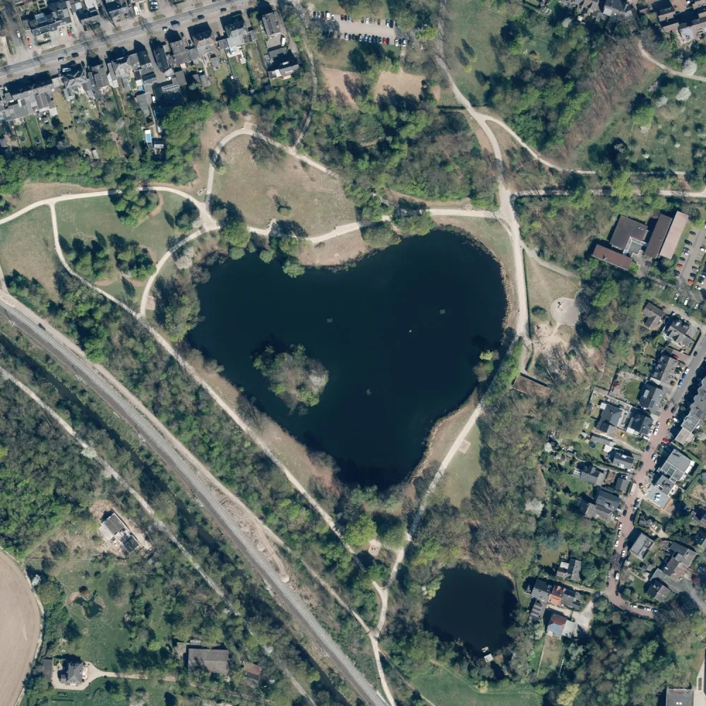
    The Jröne Meerke lake is drawn on the map as a heart. In real life it looks almost the same.

    The Jröne Meerke from above: dark heart-shaped water among the trees and paths of the park
    Luftbild: © GeoBasis NRW, dl-de/zero-2-0
The Neuss map up close: the central bundle at Hauptbahnhof and Landestheater

How the map came to be

Five chapters and one loop at Botanischer Garten that grows from frame to frame.

Each chapter shows its frames in order. Hover over a picture for the same magnifier as on the map.

  1. The tangleFigma, lines along the real streets
  2. From map to diagramAffinity, a 45-degree grid
  3. A sheet of paperformat, the Rhine and the first print
  4. Landestheatera mistake and a redo
  5. Thickersecond print and the finish

Chapter 1, in Figma

The tangle

First I had to understand how the buses here actually run. I took the timetables route by route and laid each one onto the real streets. Now I know every one of their turns, yet I never learnt the numbers. 841, 842, 843, 844, 848, 849: I still have to work out which is which.

  1. The city base map and the first lines. 857 and 857T, green and dark green, and the second already has the TaxiBus symbol. Termini are names on rectangles; this simplest of ideas will survive to the very end. I started with 842, drowned in its timetable straight away and fled to simpler routes for a while.
  2. 849 arrives, and with it the first questions.
  3. The open data insists that 849 runs along the Konrad-Adenauer-Ring. In reality it turns off towards the cemetery. Along the way it turns out that on Euskirchener and Brüsseler Straße the bus stops in one direction only, and I have to find out which. The lines are slowly straightening.
  4. 841, 842 and 848. It turns out that 848 becomes 849 at Lukaskrankenhaus, and back again. I finally sort out the main route of 842. From the station to Stadthalle the lines form a bundle for the first time.
  5. The southern tail of 841, with detours to Norf S and Allerheiligen S: the bus pulls into the station and returns via the same stops. It has to be drawn so that nobody mistakes Allerheiligen for the terminus.
  6. At the end of 842 there’s a one-way loop and a stop I had missed. 827 arrives from Düsseldorf and pulls such stunts in Norf that I take them for an error in the data. No, that’s another loop.
  7. 828 and its rather peculiar Düsseldorf section. Another one-way stretch on Windmühlenstraße.
  8. 829 and 830. Together with 828 they weave a fairly tangled web in the north.
  9. Past Haus Meer, 830 runs a long way with hardly any stops; this piece will go off the edge of the sheet. Or will it? We don’t need the loop at Haus Meer, so we straighten it. I add 833: it has exactly one stop in Neuss. Should I draw it at all? Spoiler: no.
  10. 843 and a pile of stops. The centre gets heavier with every route. And the loop at Botanischer Garten appears for the first time: remember it, it will be back.
  11. 844, in almost the same colour as 843. An accident that will later grow into the paired colours. Here too comes 850T, which will later turn out to be TB850. Like 857T it’s a TaxiBus: you can only ride it if you call ahead. But not always: the timetable has windows when it runs without a call. What a nightmare.
  12. 851 and 852 head off to Kaarst, blue and light blue, almost the same as in the final map. The Landestheater stop has already vanished under the lines.
  13. 854 and its tail to Hoisten Schleife, which it doesn’t always serve. Dashed for now.
  14. 858 quickly turns into an express and runs off the edge. Do we need it at all? Later it turns out that beyond the edge it shares plenty of stretches with our other routes. 862 joins the Düsseldorf madness. A handy route, by the way.
  15. 863, similar to 862. At Nibelungenstraße it stops in one direction only; should I pull it out of the bundle? Later it turns out that everyone there does the same.
  16. 864 and 869. So here we meet 858 again, beyond the city limits. I can’t bear to look at the curved central bundle any more, so I straighten it.
  17. 870, cut off at Grefrath for now: I don’t know yet where it goes next. And 872.
  18. 873 and 874. 872 and 873 turn out to make a huge detour to Helpenstein.
  19. 875. More and more routes cross the city limits.
  20. 877, a very strange one. The loop at Botanischer Garten grows ever more monstrous. 878 as a very thin line; later I’ll throw it out, it runs too rarely. I straighten Norf.
  21. SB85, SB53 and the railway.

Chapter 2, in Affinity

From map to diagram

Everything moves from Figma to Affinity, and the map starts turning into a diagram. The lines settle onto a 45-degree grid and merge into bundles, and the stops get their first symbols. Geography resists, and in a few places I openly do violence to it. And it’s right here that I make a mistake that will come back to haunt me: I assign the Landestheater stop to the wrong lines. I won’t notice until chapter 4.

  1. The first bundles: lines glued together and sorted by colour. Knocked-out dots appear, showing at once where lines share a stop. One-way stops still look odd: pills with an arrow inside. The U75 arrives. Lines split into thick and thin (back then I still thought there would be three weights). And a first attempt to untangle the knot at Landestheater and Stadthalle.
  2. Order begins to emerge. Tram 709 arrives and slots into the bundle with almost no bends. Route numbers step down like a staircase on translucent plates. The knot at Landestheater comes out neat and elegant: termini end cleanly, through routes go where they should. I’m proud of it. It doesn’t have long to live.
  3. The black terminus dot becomes a circle within a circle. The Konrad-Adenauer-Ring appears, with everything inside it: Dreikönigenviertel, Pomona, Stadionviertel. On the botanical loop I try making the line thinner on one-way stretches; too complicated, I give up. I’ll be back.
  4. The north: Kaarst, Vogelsang, Weißenberg and a bit of Düsseldorf. 843 and 844 get thinner past Neusserfurth, as they run less often there. SB85 runs parallel to the bundle and only touches it where it stops. This trick will survive to the end.
  5. The line is back to a single weight; it’s cleaner that way. In the south I make the arcs of 843, 854 and 849 rhyme with the Konrad-Adenauer-Ring, and the city gets a second ring. I spend a long time on the south-east: it would make sense to continue 851 and 852 as a straight diagonal, but there wouldn’t be enough room, so the diagonal goes to 841 and 854. Norf is untangled at the cost of doing violence to the geography of 852 and 827, but now it’s clear: the detours to Norf S and Allerheiligen S have become little loops. I did mix up the branches after Norf here, though.
  6. The southern routes outside the city. A beautiful triangle forms in Neukirchen, and I finally decide not to cut the lines at the city limits. I cut 877 at Marktplatz, and 873 and 874 at Dormagen-Broich, although all three have scarier variants. On the Düsseldorf side, three routes cross the Rhine, which isn’t there yet. The mixed-up branches after Norf fall into place.
  7. I find out where 864 and 870 go after Grefrath. 872 and 875 come out as plain columns of stops, with no geography at all. The railway doesn’t obey the grid yet; I thought I’d make that a feature.

Chapter 3, first print

A sheet of paper

The map is assembled; now it has to fit on a sheet and learn to talk to someone at a bus stop. The type grows, the grid firms up, the format turns. The Rhine arrives, and the map gets a face for the first time. And at the end comes the first print, a reminder that on paper everything is smaller and paler than on screen.

  1. Larger type: it was too small on screen, and now everything will have to move to make room for it. The final choice is Fira Sans: open, German in spirit and patient with long names.
  2. I lay down a grid and align the stops to it. The diagonal from the station becomes even, with equal steps, and the gap for numbers between Schwannstraße and Niedertor disappears. I’m sorry to lose the staircase of numbers, but it goes; now the numbers are stacked. 830 lines up on one vertical with 872 and 873. Beautiful, but it’s forever cramped at Bockholtstraße now: Leni-Wollenhaupt-Straße and Graf-Landsberg-Straße don’t fit anywhere, and I’ll be sweating over this stretch in every redo. The background stops being white. A place is found for Theodor-Heuss-Platz, which kept getting in the way.
  3. The map tightens noticeably. The south-eastern end of 849 swings north to stop jostling its neighbours. More violence to geography, but around Norf and Erfttal there wasn’t much of it left anyway, and it reads more easily now.
  4. A DIN A frame, and the map turns upright. The landscape sheet left huge empty areas. In portrait, the tails to Kaarst go north, while 864, 870, 869 and 858 go south. 869 and 858 are the longest, and from now on the southern edge of the map lives by their rules: when they shrink, everything shrinks.
  5. The sheet is finally cropped to format; it won’t change again. The Rhine, the harbour and the Erft arrive, and for the first time the map becomes recognisable. The city is a white island with a shadow on a light blue background. The fare zones are grey for now and hide the city limits; along the way it turns out that some zone boundaries follow the Erft exactly. The railway returns, now on the grid. The title and the coat of arms move into the empty top left corner. As it later turns out, I’m not allowed to use the coat of arms.
  6. Parks, lakes, and the heart of the Jröne Meerke. The legend grows on the right bank of the Rhine. Step-free access symbols appear, and with them a problem: there’s almost nowhere to get the data, and beyond the city limits there’s none at all.
  7. Route numbers now sit along the lines, not only at the ends. Beyond the edge of the map, instead of D-Südpark and the rest, there’s just Düsseldorf and a couple of main stations. The background turns green, and the countryside now looks like fields. I like it! I pull 870 out of the bundle at Birkhofstraße: it runs there but doesn’t stop. TB850 gets two lost stops back.
  8. First print, A2 and A3. It hurts: on paper the map is barely readable. The type grows again, and the small dots on thin lines turn into ticks. Arrows appear inside the one-way loops, and half the symbols are no longer needed. The terminus symbol takes shape: a tick with a dot. And Kastanienallee on 864 and Schloss Dyck on 870 turn out to be a short walk apart, although they’re far apart on the map, so I draw a walking connection.

Chapter 4, the redo

Landestheater

One day I sat down to check every single stop and found something I’d rather not have found. 843, 844 and 848 turn off before Landestheater, not after. That neat, elegant knot the whole map rested on was drawn wrong. From here on I’m moving half the city.

  1. I check all the stops. Missing and mixed-up ones turn up, and along the U75 there are stops the buses pass without stopping; I pull them out of the bundle. And then the Landestheater tragedy comes to light. A hotfix doesn’t help: on the map it still looks as if three routes turn after it. Along the way it turns out that almost all routes stop there in one direction only.
  2. I move the whole south and south-west left and up, so that the three routes have time to turn. The botanical loop moves left with everything else, and the vertical of 830 with 872 and 873 is broken for good. I change the order of lines in the central bundle. I cry. The next day I move the termini at Landestheater and shift 875 to the other side of the bundle. The half-circle of the Konrad-Adenauer-Ring gets noticeably denser, and it’s forever cramped inside it now. The lost zone 521 comes back.
  3. The space freed up at the ring has to be won back. I tighten the south and the arcs of 843, 854 and 849, then the south-east and south-west. The type gets a little larger.
  4. The south and south-west are sorted, the south-east is done. With the new order in the bundles the crossings read badly, so I change the line colours again. And I rearrange everything that doesn’t fit with the new type.
  5. A new grid, starting from the north: labels and lines align to the text baselines. I redraw the harbour; I didn’t like the old shape. I change the colours again. The bend at Helpenstein gets deeper: the label doesn’t fit, a great excuse to be a little closer to the truth.
  6. I tighten the south-east a lot, and problems start right away in Erfttal and Norf. The next day I tidy up. The eastern loop of 842 at Rheinpark-Center turns again, and the Rhine shifts a little.

Chapter 5, second print

Thicker

Second print. The type is fine now, but on paper the lines still look skinny. I decide to make them thicker, which means yet another complete redo: thick lines need more room, and the map ran out of room long ago. But in this chapter everything finally comes together, the loop at Botanischer Garten included.

  1. The tightening pays off: the whole map can be scaled up a little. The operators’ logos move to the top left corner, the title to the bottom right. It turns out the city has released an open version of its coat of arms for anyone to use, so I take it. The termini at Landestheater and Stadthalle are still hard to see. I print.
  2. The lines are still thin, so I thicken them. But on one-way stretches two thick lines instead of one turn into a motorway, and I go back to an idea I dropped long ago: where the bus runs in one direction only, the line is thinner. I change the colours of the zones and parks.
  3. The botanical loop resists: making the line thinner there is really hard. The one-way stops with arrows, which flickered like Z̫͓̟̾̿̈́a̢̼͙̿͌͘l̺͕̼͛̿͝g̡̦͇̀͝͝o͇͔̓͆͠, finally go, replaced by little triangles. The ticks get a notch, and now you can see them.
  4. To keep the lines in the bundles readable, I add thin white veins between them. Wide gaps would flicker; thin veins don’t. But it means the whole map all over again: thicker lines, less room for labels.
  5. The botanical loop moves down and finally looks decent; Schulzentrum slides further down the loop. 864 now turns towards Landestheater: it used to run straight across, and there was no way to show the stop. The termini at Landestheater and Stadthalle become pills, which I had avoided all through the project, but now you can see them. The route number sits in a gap in the line.
  6. I tidy up after the thickening and shuffle the colours again. Schillerstraße and Dreikönigenstraße become one stop.
  7. I remember that the vertical of 830 is gone, and put 830 back so that the U75 turns nicely. A proper junction forms at Handweiser, and the stretch at Pomona becomes diagonal. The background changes, but the green “fields” stay for now.
  8. The background and zones are completely recoloured. No more coloured zones inside the city: the city is white, and its boundary is visible at once. A dark plate goes under Hauptbahnhof, marking it as the main hub. The terminus plates and labels at Landestheater and Stadthalle are laid out anew. That knot is now not entirely terrible.
  9. The “line continues” arrows become double chevrons. I find an outline for termini in loops, so the line seems to lock itself neatly. Zone boundaries inside the city are dashed. Numbers move inside the lines across the whole map. Done.

In real life

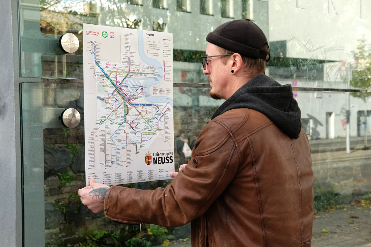
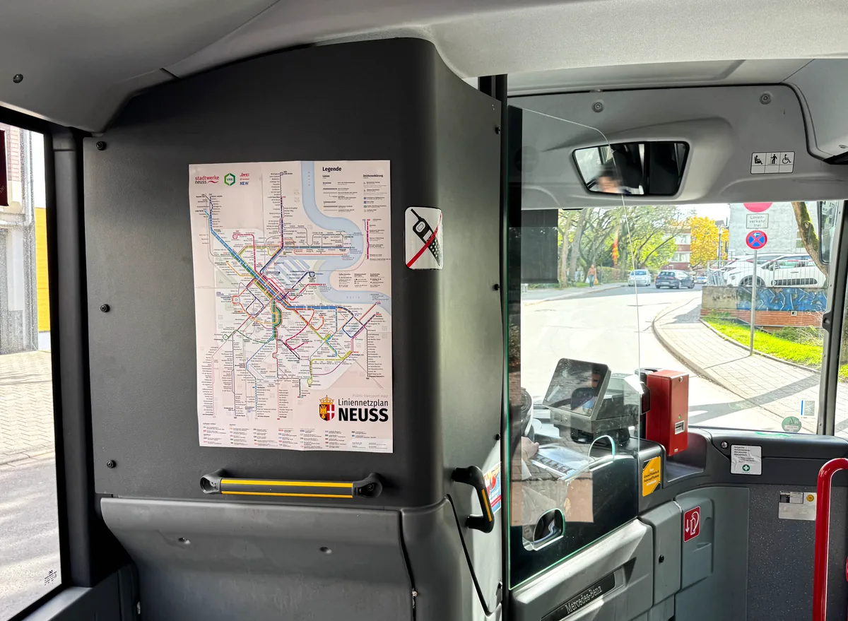
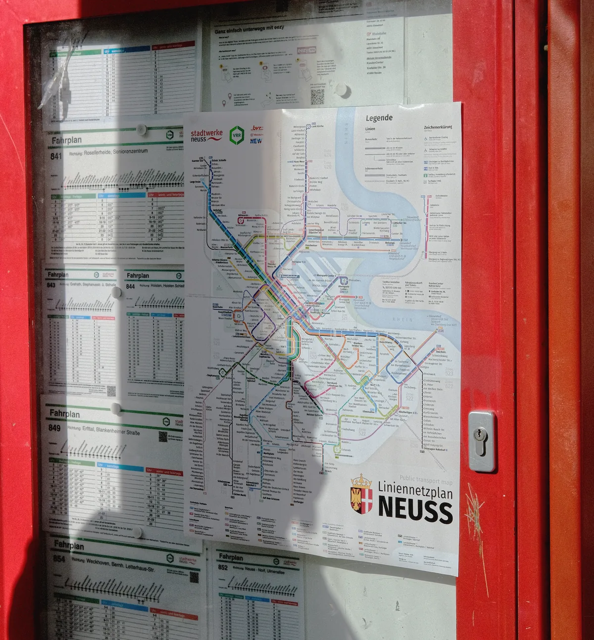
This bus map was made for the stop, not for the screen. So I printed it and tried it out where people will actually read it.

Vlad sticks the printed map onto the glass of a bus shelter
Trying it on at a stop. The map hangs on the glass, and people waiting for the bus read it from a couple of steps away.
The printed map on a partition inside a bus, next to the driver’s seat
On the bus. Inside, it is read on the move, under artificial light and from the far seats.
The map stuck over a red timetable case at a stop
Map and timetable. Right on top of the timetable case, in bright sun. Next to all those dense tables, the map mustn’t get lost.
Vlad Neimark

About the author

My name is Vlad Neimark, I’m a designer and I live in Neuss. I’ve loved transit maps since childhood: I grew up in Moscow, where the metro map changes almost every year, and I pored over each new version the way other kids pore over treasure maps.

In my spare time I draw maps for cities that don’t exist, in Cities: Skylines. At some point I realised it was time to draw a map for a real city. My own.

If you work in transport or for a city and need a map, write to me.

Vlad Neimarkdesigner, Neuss

Write to me